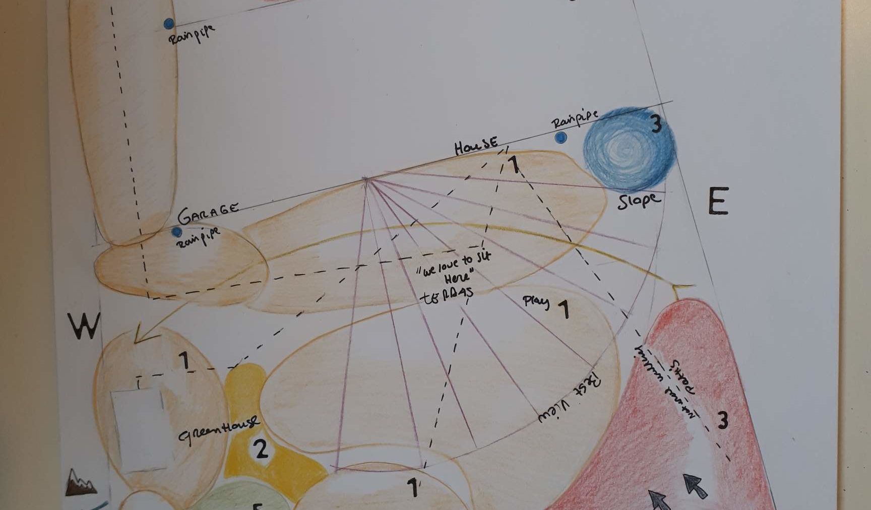
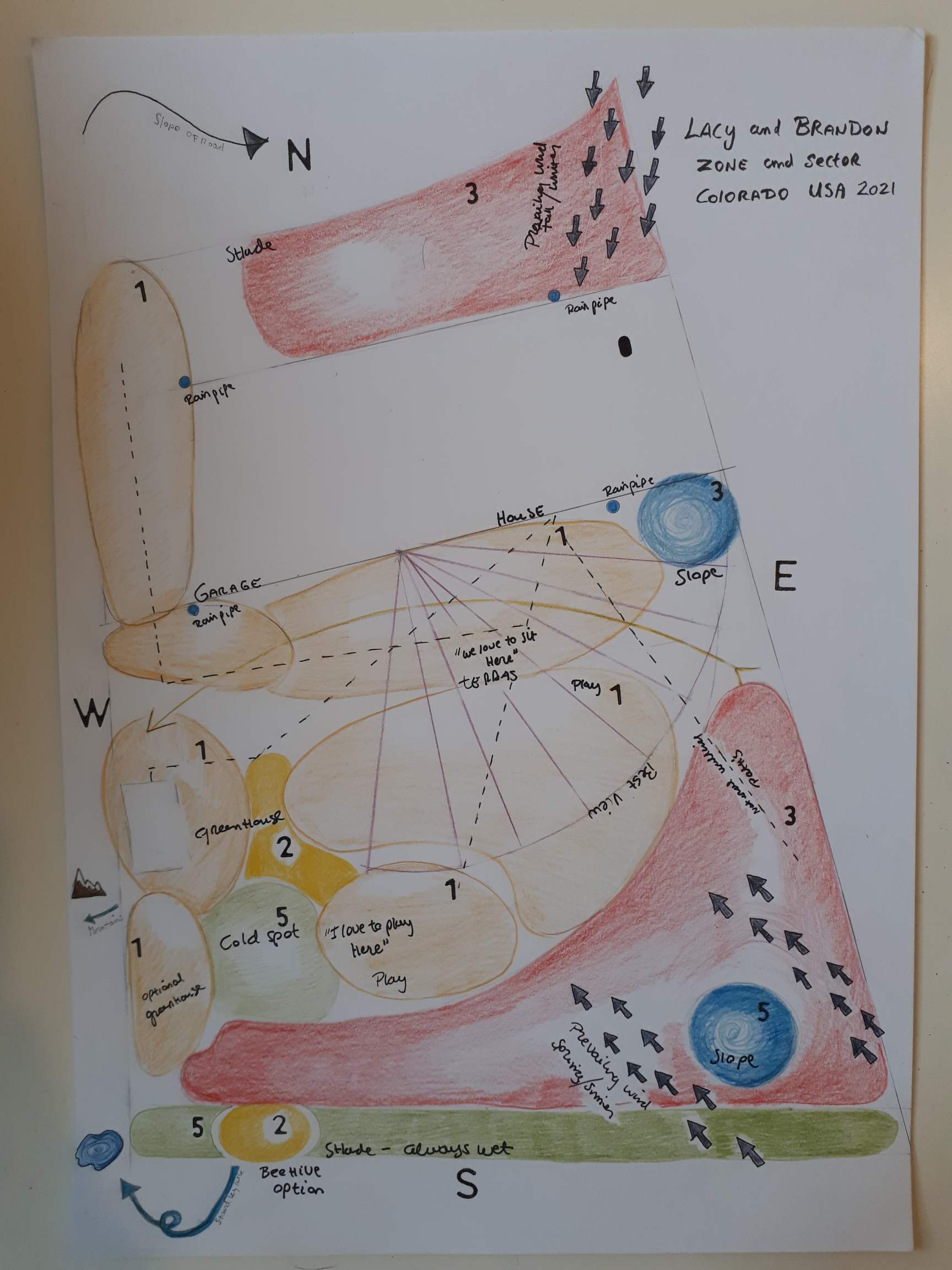
After our initial consult with our landscape designer, Marjolein Schuit, she created a classic permaculture zone and sector map of our property.
This isn’t a design, but rather a map to sort of show what’s happening with our property and what will be in each area as she designs.
It includes wind patterns (the grey arrows), and “water” features (which right now are just lower areas on our property).
She’s also indicated where the lake and mountains are in relation to our property, because they contribute to our microclimate — and the funny cold spot we experience.
Explaining the permaculture zones
In permaculture, the land is divided up into zones based largely on how often people visit them and what their purpose is. It’s also determined by how much energy is put into maintaining it. So, an annual vegetable garden requires a lot of tending and is in zone 1, whereas a copse of trees where you gather firewood, but don’t do much other tending might be zone 4 or 5.
Zone 0 is our house and garage, where we live.
Zone 1 are the areas we visit every day. On our property it includes our patio, where our annual vegetable garden will be, Brandon’s greenhouse, and Devyn’s play area.
Zone 2 is for domestic animals, which in our case might include chickens, bees, and a root cellar for storing our extra food.
Zone 3 is our front yard and our food forest. We don’t visit these areas as often as zone 1 and 2, but we will visit them to harvest food and do seasonal things. In the front yard we’ll have a shade garden (because it’s on the north side of the house and also shaded by a big, beautiful linden tree). The food forest will include plants at all levels (trees, shrubs, and low-growing plants).
The green area marked 5 is right up next to our fence where it’s almost always shaded and the snow lingers much longer than the rest of the yard. This will be the “wildlife” area where we just sort of let nature do its thing. (We don’t really have a zone 4, which makes sense because our property is so small, comparatively.)
If you’d like to listen to Marjolein talk about our zones and sectors, check out this video she made for us.
Another cool thing she shared with us is that she’s testing out using GIS maps to show the contour lines of elevation on our property, which indicate where water will flow and how to improve the landscape.

I can’t wait to see what’s next for our design!